

Historical Summary
See our history book for a more detailed history
The locality
The Lye is situated about 2 miles northeast of Stourbridge along the ridge of the 33ft (10m) seam of coal that produced the area now known as the Black Country. Prior to the industrial revolution the area only contained forests and sparsely spaced farmhouses. It is possible that most of the original settlers may have been displaced by the civil war between the Royalists and the Parliamentarians after the Battle of Worcester in 1651, using a law allowing settlers to make claim to 4 acres of manorial wasteland on which they had to build a dwelling, complete with fire, in 24 hours; hence the area being known as Lye Waste. They generally lived very basic lives in poor accommodation and were prepared to tackle any job.
The associated metal bashing industries that grew up with the development of the mining and iron production allowed the trade of nail and chain making to be predominant in the Lye. The 1851 Population Census identified 5,901 adults residing in Lye & Wollescote together with 2,098 children under the age of 12, whilst only 23 had attained the age of 80! Most of the men were miners and farmers, but 81 boys and 71 girls under the age of 12 were nailmakers, and 28 boys and 4 girls were recorded as being chainmakers. The River Stour (26 miles long, Wychbury Hill to Stourport, with a fall of 200 metres) provided the necessary power for spades and other hand tools to be made, and the area grew to become one of the main populated districts, with Wollaston providing the residential accommodation between Lye and Pedmore.
History of the Chapels
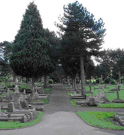
The cemetery has been the final resting-place for many people of the Lye and Wollescote, since it opened in 1879. The Lye & Wollescote Burial Board purchased 7 acres and 22 perches of land forming part of Docker's Farm and in the occupation of Perry & Brooks, nail manufacturers, from Thomas Henry Pargeter for £2,500. The emergence of the large cemetery is regarded as being a major nineteenth-century innovation and the Lye & Wollescote cemetery is an excellent example of this phenomenon. Large cemeteries were brought into existence because of
- the insanitary state of over-crowded church graveyards and
- the Victorian obsession with death or what is sometimes referred to as 'the celebration of death'.
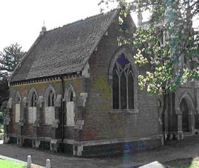
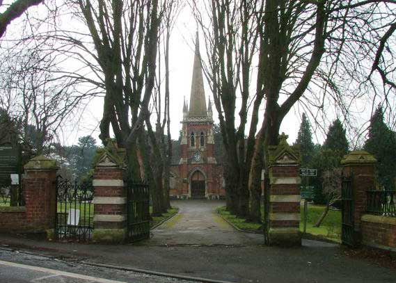
During the 19th century, cemeteries were designed to replicate landscaped parks: at the entrance would be the portal combined with the gatekeeper's lodge, the centre of the cemetery would be usually taken up by two chapels, one for Anglicans and one for nonconformists, which were linked in some cases by a porte-cochere (a structure extending from the entrance of a building over the place where vehicles stop to discharge passengers) carrying a clock tower or turret. The Lye & Wollescote Cemetery and associated buildings generally follows this classic layout including a clock tower, although there is no evidence of there ever having been a porte-cochere.
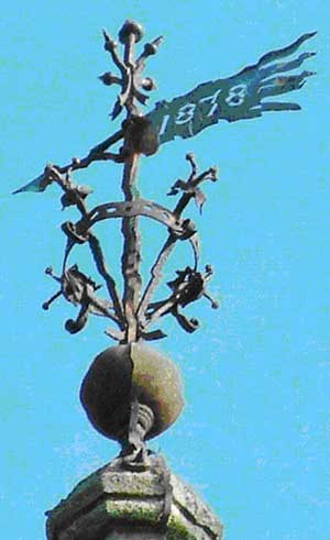
The Lye & Wollescote Cemetery and Chapels were opened in 1879. The chapels building and cemetery were divided into two distinct halves, the west used by Anglicans and the east used by nonconformists; the Anglican half is consecrated land. In 1912 the clock was installed by A Webb Ltd of Lye to celebrate the coronation of King George V.
Description of the building
Access to the mortuary chapels is obtained via Cemetery Road, through a set of wrought iron gates carried by gate pillars composed of alternate courses of red brick and limestone with elaborately carved copings. The gate-posts and boundary wall are contemporary in date with both the chapels building and Superintendent's house and all are constructed in the Gothic style.
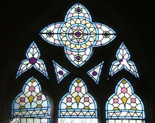
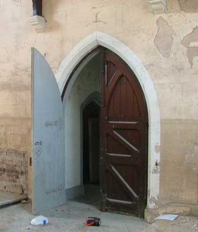
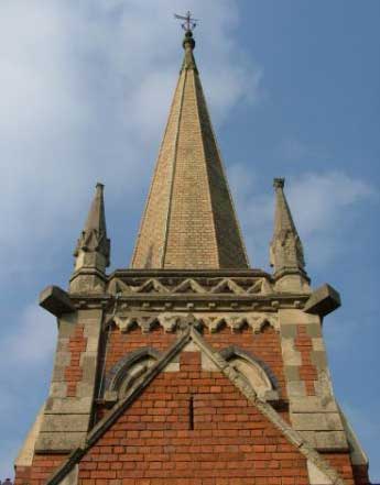
The mortuary chapels building is a perfectly symmetrical structure; it is 'H' shaped in plan, constructed in red and blue bricks with limestone used for window and detailed ornamentation. Its plinth is constructed in several courses of blue brick followed by a course of limestone with red brick used for the main bulk of the building. All the windows are limestone tracery windows with limestone hood moulds, they are either two-centred arched windows or four-centred, apart from the two 'Rose' windows or 'wheel' windows located in the south-facing gable-ends of the two chapels. The same limestone has been used for the coping stone and parapet detail on the gable-ends of the two chapels as well as for the kneelers and door architraves. At eaves level there is a limestone dentil eaves cornice. Plain clay roof tiles have been used for the roof covering, lain in decorative bands of fish-scale tiles and plain tiles. The spire is constructed in yellow engineering brick.
Located below the west chapel is a barrel-vaulted cellar, access obtained externally from the south side of the building down a series of narrow steps. The cellar is fortunate enough to have a reasonable amount of headroom and therefore has potential for conversion. The cellar possibly functioned as a morgue.
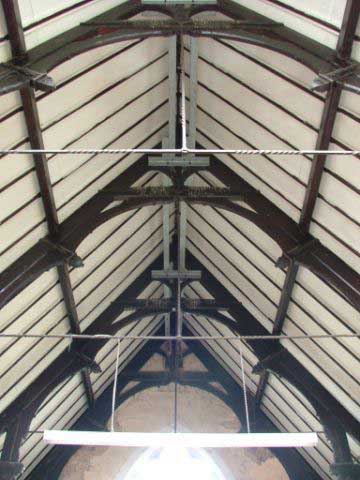
Both chapels have hammer-beam roofs with lateral iron-ties spanning between the upper sets of hammer-posts. In the east chapel, the original tile floor still survives in-situ. Regrettably the pews, alters and church furniture have long since been removed. The adjacent Superintendent's house (SMR 4684) is a 2-storey dwelling, also Gothic in style built in the same red and blue bricks with limestone decoration.
Select the photos below to see a larger view. Photos taken by Brownhill Hayward Brown, conservation architects.
Select the photos below to see a larger view. Photos provided by Dudley MBC.